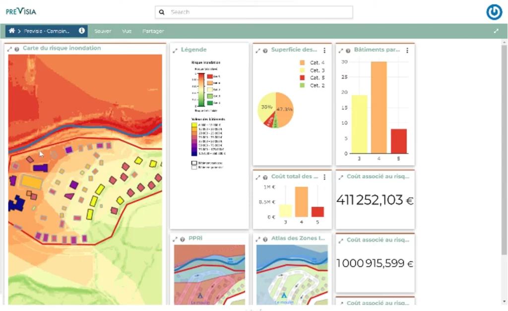
Access detailed risk reports for individual sites. The analyses are based on data from multiple reliable sources, providing a robust foundation for informed decision-making.
02.
Scientific Expertise
Developed in collaboration with experts in ecohydrology and environmental sciences.
03.
Multi-source, multi-layer data
Integration of diverse data sources for a holistic analysis.
.
04.
Exposure scoring
Detailed and fully customisable assessment of risk exposure for each site.
05.
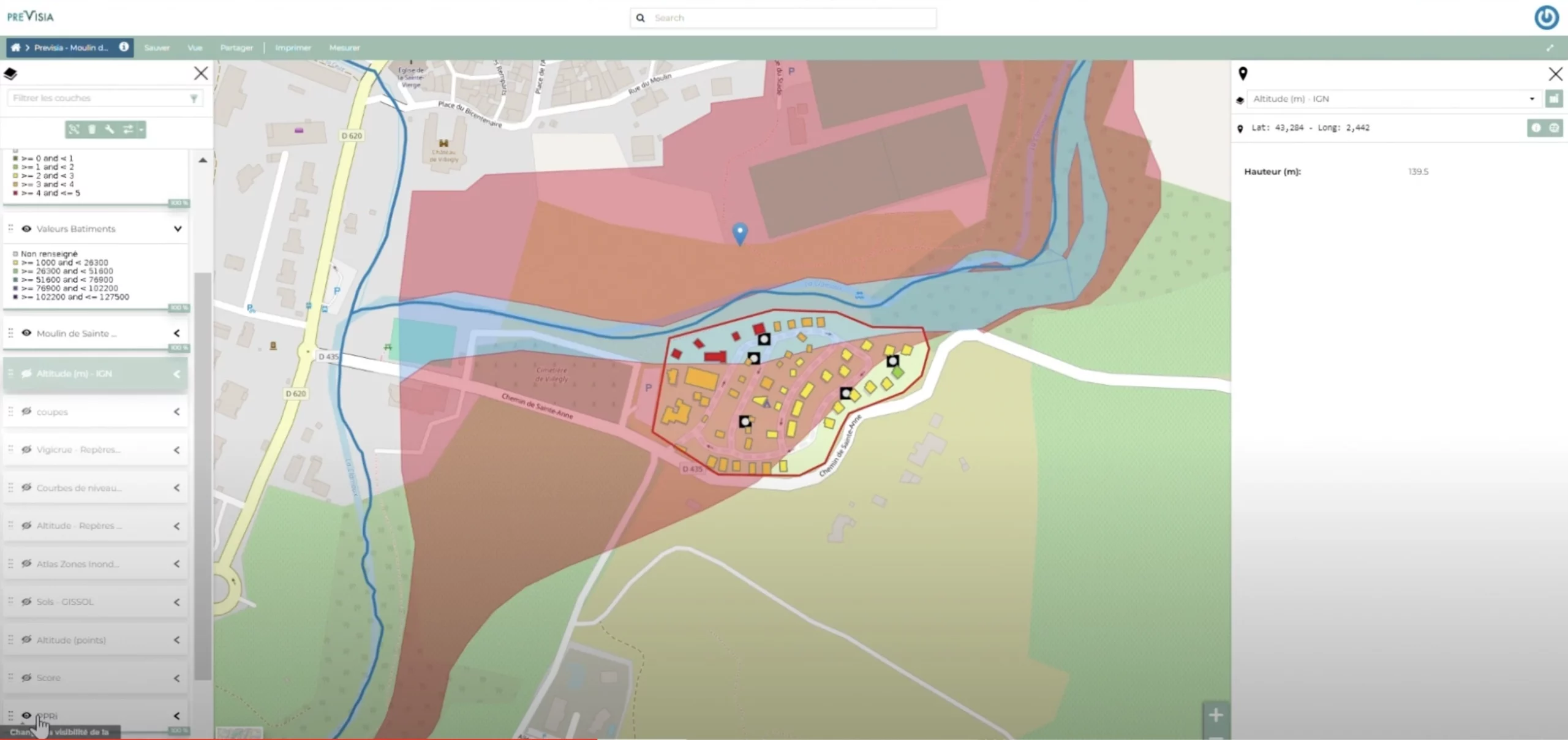
Water-level modelling
Advanced modelling based on historical flood levels to realistically simulate potential risk scenarios.
06.
Assessment of Exposed Assets
Identification of exposed physical assets within each risk zone, giving you a clear overview of potential financial impact.
Custom use caseA practical example from the outdoor hospitality sector, demonstrating the flexibility and adaptability of the solution.
How do you rate the added value of the risk inspection ?
4,6/5
Were you satisfied with the content and duration of the inspection ?
4,6/5
Compare plans
Transparent and fair pricing at every stage.
Previmap Lite
Previmap Pro
Data and configuration for push-based site visits via the app
Google Maps coordinates
Flood risk algorithm
Supplementary maps
PDF report including selected map visualisations and a static dashboard
Navigating the MEWISO interface
Position data and customer asset valuation
-
Push data relating to sites and assessment of client assets
-
Dedicated asset maps linked to the PREVIMAP dashboard